
On a short distance from Oslo, just above Maridalen lake, you have access to a great forest with countless little lakes and some stunning viewpoints. This time I take you into Turtermarka for a short hike of just over 6 km. Expect some beautiful sights!
While it’s January 2017, the weather is rather disappointing. According to the Norwegians there should be snow and freezing cold temperatures. None of that is the case. It’s above 0° and snow is nowhere to be seen. In fact, the trails are almost ice free! This, in one way, is of course the perfect weather for a wonderful hike.
I set out for a short hike in Turtermarka. Turtermarka is a small forest area about 5 to 10 minutes north from Oslo. It offers good parking facilities and it’s not far away from civilization. Setting out for this 6 km hike is therefore more of a leisure experience than a true and long hike. Don’t underestimate the ascent though. In the first 3 km you make an ascent of about 250 meters. This can be perceived as steep.


The trail up to Fagervann
After parking the car I make my way up a wide path. While this offers an easy walk, the ascent will warm you up quickly. IÂ expected some wonderful views over Maridalen lake but the trees block the sight most of the time. Nevertheless there are some small glimpses of beauty trough the trees. On this day the overcast causes the view to look a little dull.
The higher up I get, the more ice patches appear. No, there is definitely no snow. It has been too warm, making sure all surface is either icy or very wet and swampy. At Fagervann, a little lake at 417 meter above sea-level, I reach the first highlight of the day. The lake is beautiful and covered in a thick layer of ice. The recent plus degree temperatures caused the lake to have a thin film of melted water over the ice.
At the lake I find a cabin in typical Norwegian style. The cabin is currently empty and from the looks of it, this is one of the many cabins you can find in the Norwegian forest and are available for hikers. While I’m not sure if this cabin is associated, being a member of the Norwegian Trekking Association gives you the possibility to rent a DNT key. Paying a deposit, this key will give you access to these kind of cabins in which you can stay for the night. Expect basic conditions and forget about electricity and such kind of luxury!


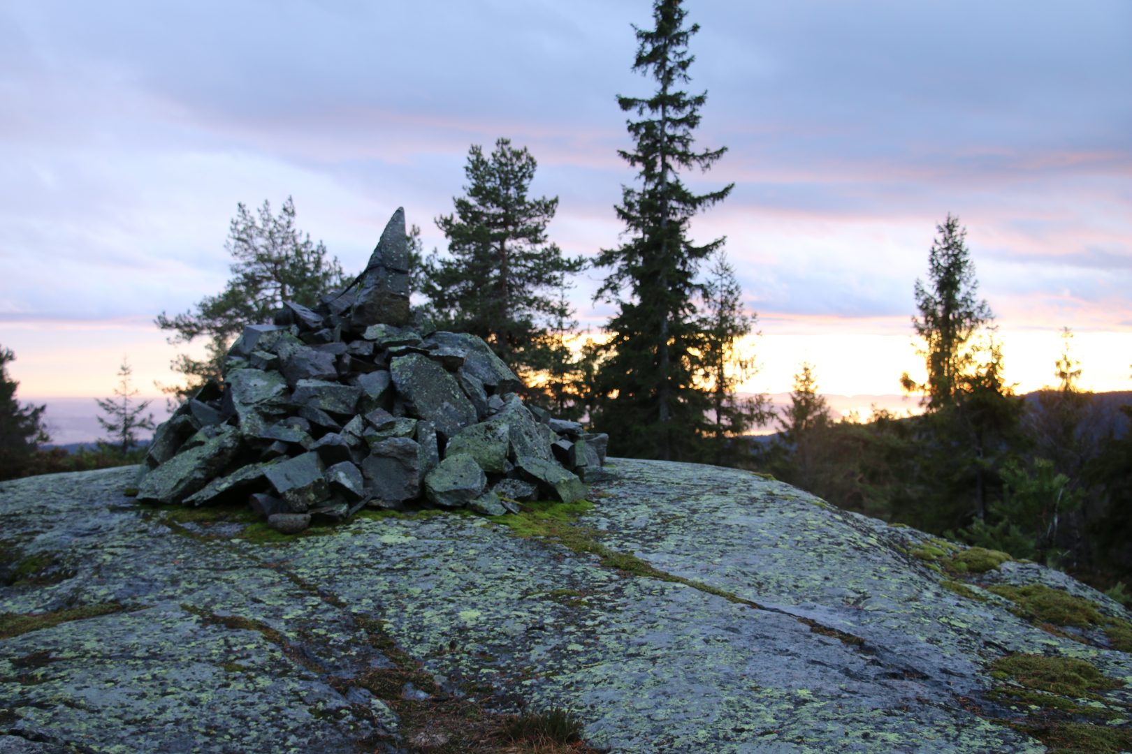
Sunset view from Båhushøgda
With little time to spare, I head on to highest point of my hike. Following a mushy and wet trail, I end up losing the path I was on. Luckily this is only shortly. The distance between Fagervann and Båhushøgda is also very short but, as expected, still upwards.
BÃ¥hushøgda is probably the highest point of Turtermarka and offers a majestic panoramic view over Oslo fjord. As usual during hikes in the Norwegian forest the treeline will break up your sight a little. I’m lucky though. The clouds have opened up to allow the sunset to shine trough and the scene is beautiful. BÃ¥hushøgda offers a good view over Norway’s biggest city and capital to deep into Oslo fjord, it’s a wonderful sight.


From here it’s downwards. And for me, a little fast too. With darkness approaching I walk into a dense forest, giving this short hike yet another twist. It’s Norwegian legend that if it’s misty, trolls might come out and they ain’t too friendly towards humans. I made it out just in time…
Details on the Turtermarka hike
This hike is, for the fit, a very easy hike to do. With 6 km it might even seem short, but the ascent and decent add a little to the effort. It took me 2,5 hours to complete the hike, but I sure took my time to enjoy Fagervann lake and the panoramic views at Båhushøgda.
If you’d like to follow my footsteps, you can download the GPX coorinates from here. The Wikiloc app and for a small fee get a very detailed, offline map which will help you immensely when setting out your own path.